Danube map length
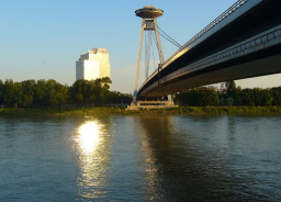
On the map of Bratislava, with a scale of 1:200,000, the length of the river Danube is about 12.3 cm. Approximately how many km of Danube flows through this area?
Your answer:
Your answer:
Tips for related online calculators
Do you want to convert length units?
You need to know the following knowledge to solve this word math problem:
Units of physical quantitiesthemes, topicsGrade of the word problem
Related math problems and questions:
- Rhine Danube length
 The length of the Rhine is 3/7 the length of the Danube. Both together are 4000 km long. How long is each river?
 - The Europe
 The map of Europe is made at 1:4000000, and the distance between Bratislava and Paris is 28 cm. When will an airplane flying 800 km/h fly this journey?
 - Forest square map
 A forest with a square plan has an area of 4 square km. What side will the square have on a 1:50,000 scale map?
 - City distance centimeters
 The cities are 400 km apart; how many cm is it on a 1:400,000 scale map?
 - Map scale setting 2.5 cm on the map represents 6.25 km in reality. Set the scale of the map.
- Map line
 On a map at a scale of 1:250,000, the line shows a distance of 15 km. How many cm does this line measure on the map?
 - Map scale distance
 The map has a scale of 1:2500000, and we measured a distance of 4 cm on the map. What is the distance in km?
