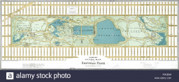
Central Park
Central Park is a rectangular park in New York City, and the map scale is 1 cm: 320 m (It means 1 cm on the map represents 320 m in the real world. ). Find the north-south distance if the length on the map is 2.5 cm.
Your answer:
Your answer:
Tips for related online calculators
Do you want to convert length units?
You need to know the following knowledge to solve this word math problem:
arithmeticUnits of physical quantitiesthemes, topicsGrade of the word problem
Related math problems and questions:
- Scale model
 In a model train set, 1.38 inches represents one foot in real life. The height of One World Trade Center in New York City is 1776 feet. How tall would a scale model of the building be? Should you calculate 1776 x 1.38 or 1776 ÷ 1.38?
 - Central park in city
 A city park is rectangular, 180 m long and 120 m wide. People walk diagonally through the centre from one corner to the opposite corner. How many metres shorter is this path compared to walking along two sides of the perimeter?
 - Air 2
 The air distance between New York and Los Angeles is 3,962 km. How many km does 1 cm on a map represent if the map scale is 1:1,000,000?
 - A map 3
 A map is drawn on a scale of 1:25000. This scale can be expressed as 1 cm representing n km. Find n.
 - Football field scale
 What is the scale of the city plan if the new football field with dimensions of 90 m by 120 m is shown on it as a rectangle with dimensions of 3 cm by 4 cm?
 - Shyambazar
 Shyambazar is 3 km north of college street, and Park Street is 7 km south of college street. What is the distance of Shyambazar from Park Street, and in which direction?
 - City distance centimeters The cities are 400 km apart; how many cm is it on a 1:400,000 scale map?
